


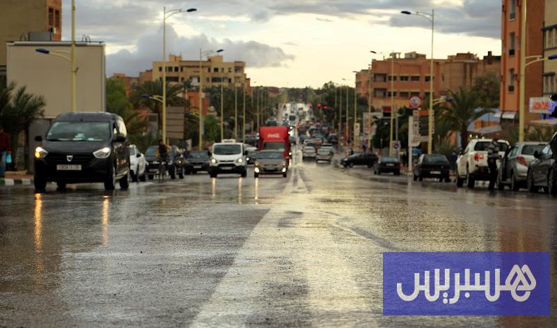
Morocco is experiencing unstable weather at the start of this week due to a low-pressure system from the Mediterranean, accompanied by moist and cold air currents coming from the North Atlantic Ocean, interacting with relatively warm air masses rising from the south and east.
This convergence, according to El Hossein Youabed, Head of Communication at the National Meteorological Directorate, in a statement to Hespress, leads to atmospheric instability conducive to the formation of cumulonimbus clouds, accompanied by thunderstorms, scattered rain showers, strong winds, and sometimes dust storms in several areas.
Regarding the weather details, Youabed said that on Monday local thunderstorms accompanied by hail are expected over the eastern plateaus and the eastern Middle Atlas, while the regions of Tangier, Loukkos, and western Rif will see light and scattered rain. He added: “At night, low clouds, fog, or light drizzle will form in the northwest of the southern provinces, while the central coasts, southern provinces, and south of the eastern region will experience relatively strong winds, with a possibility of local dust storms.
Maximum temperatures will range between 34 and 39 degrees Celsius in the southeast and southern provinces, between 28 and 34 degrees on the slopes of the southeast, inside Souss, and inside the southern provinces, while they will not exceed 17 to 23 degrees in the northwest, Rif, Atlas, and coasts, stabilizing between 23 and 28 degrees in other areas.
For Tuesday, the same source mentioned that thunderstorms will appear after noon in the far south, with occasionally cloudy skies and scattered showers on the Mediterranean coast and northwest of the southern provinces; fog banks will form on the central coasts, and relatively strong winds will blow south of the eastern region and the far south, with dust storms. He noted that maximum temperatures will rise in the northwest and south of the eastern region.
Regarding Wednesday and Thursday, the source added that thunderstorms will return to the southern provinces, remaining locally significant on Thursday; fog or light drizzle will form on the Mediterranean coasts, northern southern provinces, the eastern region, and the northern Atlantic plains. Maximum temperatures will see a slight increase in the north of the country.
In a special warning bulletin issued by the Meteorological Directorate on Sunday, September 28, 2025, warnings were issued of severe thunderstorms with rainfall amounts ranging between 50 and 80 mm affecting the provinces of Oussard and Oued Ed-Dahab, starting from Wednesday, October 1 at 12:00 noon until Thursday, October 2 at 6:00 pm.
Youabed pointed out that from Friday until the end of the week, the weather will remain relatively stable, with fog forming at night and morning on the Atlantic coasts, while temperatures will generally remain stable without significant changes.


Recommended for you
Talib Al-Rifai Chronicles Kuwaiti Art Heritage in "Doukhi.. Tasaseem Al-Saba"
Exhibition City Completes About 80% of Preparations for the Damascus International Fair Launch
Al-Jaghbeer: The Industrial Sector Leads Economic Growth
Unified Admission Applications Start Tuesday with 640 Students to be Accepted in Medicine
Egypt Post: We Have Over 10 Million Customers in Savings Accounts and Offer Daily, Monthly, and Annual Returns
His Highness Sheikh Isa bin Salman bin Hamad Al Khalifa Receives the United States Ambassador to the Kingdom of Bahrain